


Virendra Pandit
New Delhi: The World Meteorological Organisation (WMO) sees 80% chance of El Niño’s impact unfolding by August, and the chances of the drought-bearing weather persisting beyond November exceed 90%, the media reported on Tuesday.
The WMO is a specialized agency of the United Nations responsible for promoting international cooperation on atmospheric science, climatology, hydrology, and geophysics.
Most of the planet is predicted to see above-normal temperatures in the June-July-August season, risking heat stress in some regions and accelerating the onset of drought.
In the past, El Nino events have led to either late arrival of the South-West monsoon or deficient rain, besides prolonged dry spells. However, before El Nino emerges this time, India could receive above-normal rainfall.
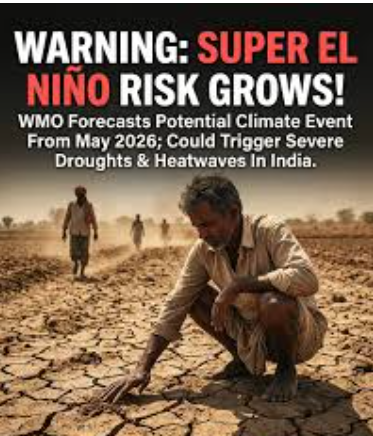
According to the WMO’s latest update, there is an 80 per cent chance of an El Nino event emerging between June and August 2026, with the chances of this continuing until at least November near or above 90 per cent.
Forecast models generally indicate at least a moderate El Nino, possibly a strong one, although there is still some uncertainty regarding the peak strength and timing.
El Nino is a phenomenon involving the warming of ocean surface temperatures in the central and eastern equatorial Pacific Ocean. It usually happens every two to seven years and lasts for about nine to twelve months.
Climate warning
Between March and June is when it normally begins to develop, and between November and February is when it reaches its maximum intensity, the impacts of global temperature generally being most pronounced in the second year after development.
“The science is clear: El Nino is arriving on our doorstep in the coming months with 90 per cent certainty. The world must treat it as the urgent climate warning it is. El Nino conditions will pour fuel on the fire of a warming world. Impacts will hit even harder, travel even farther, and cross borders with devastating speed. The only effective response is climate action equal to the crisis – ending the addiction to fossil fuels, accelerating the shift to renewables, protecting the most vulnerable, and delivering early warning systems for all,” said UN Secretary-General António Guterres.
According to observations from different platforms used by the WMO, from late April to mid-May, the sea surface temperature in the central-eastern Equatorial Pacific, the area used as a monitoring reference, was approaching El Nino thresholds.
These increasing surface anomalies have been driven by anomalously warm subsurface conditions across the tropical Pacific, with temperatures exceeding 6°Celsius above average.
These subsurface temperatures contain a large reservoir of heat that feeds the observed warming at the surface.
The Southern Oscillation Index, the atmospheric component of El Nino, also is consistent with developing El Nino conditions.
Impacts
Every El Nino event is different in its evolution, spatial pattern and impacts.
It is usually associated with increased rainfall in parts of southern South America, the southern United States, parts of the Horn of Africa and central Asia and drier conditions over Central America, northern South America, the Caribbean, Australia, Indonesia and parts of southern Asia.
“We need to prepare for a potentially strong El Nino event, which will exacerbate drought and heavy rainfall and increase the risk of heatwaves both on land and in the ocean. The most recent El Nino, in 2023-24, was one of the five strongest on record, and it played a role in the record global temperatures we saw in 2024,” said WMO Secretary-General Celeste Saulo.
In the boreal summer, warm water associated with El Nino can help feed hurricanes in the central/eastern Pacific Ocean but hinder the development of hurricanes in the Atlantic Basin. The US National Oceanic and Atmospheric Administration (NOAA) is predicting an Atlantic basin hurricane season below normal this year.
The South Asian Climate Outlook Forum also predicts below-average monsoon rains in South Asia.