China Defends Rigged Map to be “Routine,” Advises India not to “Over Interpret”
Manas Dasgupta
NEW DELHI, Aug 30: Even as China asked India to “stay calm and refrain from over-interpreting” its map showing the whole of Arunachal Pradesh, Aksai Chin and several other parts of India as Chinese territory, China’s continuous move to invest in hardened military complexes in close proximity to the Line of Actual Control appears to indicate that it is “digging in for the long haul.”
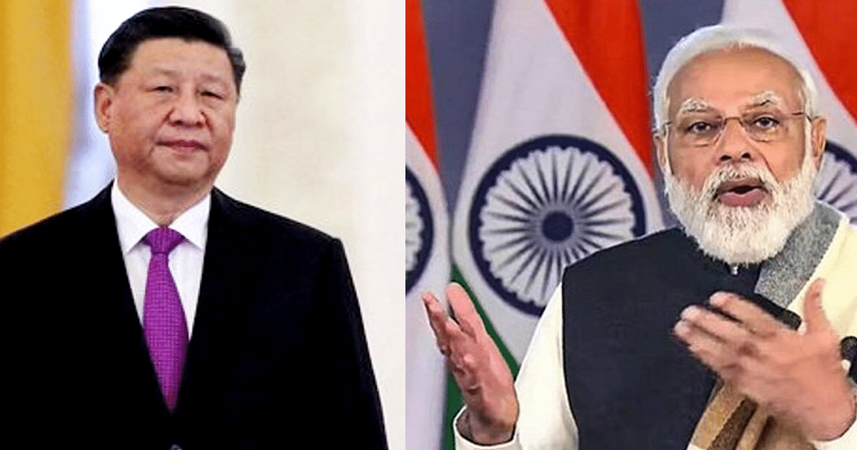
Though military-to-military talks on de-escalation may continue, and the prime minister Narendra Modi and the Chinese president Xi Jinping may keep shaking hands and claiming to have asked their respective officials to “expedite the process of de-escalation on the LAC,” China has refused to take India’s protests seriously and has gone ahead with building up structures along the LAC without any qualms.
China on Wednesday called the publication of the disputed map a “routine practice” and advised India not to over-react on the issue. Asked about India’s protest, Chinese Foreign Ministry spokesperson Wang Wenbin said the map, put out by the Ministry of Natural Resources, was “routine.” “It is a routine practice for China to exercise sovereignty in accordance with the law,” he said. “We hope the relevant side can stay objective and calm, and refrain from over interpreting.”
India had lodged a strong protest over the new map that was released on Monday, and showed within China’s borders all of the Indian State of Arunachal Pradesh, Aksai Chin, as well as the entire South China Sea. While these territories were also displayed in previous Chinese maps, the new publication was seen by New Delhi as an unnecessary move that will only further complicate already tense relations, particularly over the border issue.
While China on Wednesday downplayed the move, Beijing for its part had in 2019 strongly objected to India’s map showing the newly created union territory of Ladakh, although New Delhi had underlined to Beijing then that the map had not changed India’s external borders. It still drew a strong protest from Beijing at the time.
External Affairs Minister S. Jaishankar on Tuesday said the government “is very clear about what is our territory” and “making absurd claims does not make other people’s territories yours.”
A day after India dismissed he Chinese map as “absurd,” the Congress leader Rahul Gandhi on Wednesday asked the Prime Minister to speak on the issue of Chinese incursion. Gandhi, interacting with the media said, “I have been saying this for years now that the Prime Minister’s claim that not an inch of land has been taken away from Ladakh is a complete lie. I have just come back from Ladakh and all of Ladakh knows that China has usurped our land,” Gandhi said.
“The map is a very serious issue but they have already taken land. The Prime Minister should speak about it,” he added. Reacting to the Chinese map, the Congress president Mallikarjun Kharge called China a “habitual offender” and urged India to raise this issue at the upcoming G-20 Summit in New Delhi. “We hope that the G-20 summit in India, will be another opportunity for us to expose the issue of China’s transgressions into Indian territory at the global stage,” Kharge said.
India has initiated protests through diplomatic channels over the “standard” map. “We reject the claims as they have no basis. Such steps by the Chinese side only complicate the resolution of the boundary question,” MEA spokesperson Arindam Bagchi said in a statement. The map has surfaced at a critical time as India gears up for the G20 Summit scheduled for September 9-10.
Pin-pricking from China has continued all along. In April, this year, China announced new Chinese names for 11 places in Arunachal Pradesh. India rejected the renaming, asserting that Arunachal Pradesh is an integral part of India and that assigning “invented” names does not alter the reality that the north-eastern state is under Indian administration. This was China’s civil affairs ministry’s third addition to the first batch of six places released in 2017 and the second batch of 15 places released in 2021.
Sixty kilometres east of the Depsang Plains in Northern Ladakh, Chinese forces have begun carving tunnels and shafts into a hillside along a narrow river valley to construct multiple reinforced shelters and bunkers for soldiers and weaponry. The site lies in Aksai Chin, East of the Line of Actual Control, in territory held by China and historically claimed by India.
International geo-intelligence experts have identified the presence of at least 11 portals or shafts bored into the rock face on both banks of the river valley. The images show massive construction activity over the last few months and are a likely attempt to protect heavy weaponry and soldiers from Indian airstrikes and extended-range artillery.
Experts see China’s activities in Aksai Chin as an act of desperation to offset India’s advantage. “By establishing underground facilities and developing subterranean infrastructure in such proximity to the border, Chinese strategists seem to be aiming to counterbalance the current advantage held by the Indian Air Force in Aksai Chin,” some experts said.
The Indian Air Force operates a host of frontline airbases ranged against China across the Ladakh front. While Srinagar and Avantipura have traditionally been frontline IAF fighter bases, the Indian Air Force is also looking to extend the runway at the Air Landing Ground in Nyoma, which is located at an altitude of 13,700 feet near the Pangong Lake. Extending the runway at Nyoma would enable the IAF to host fighter aircraft less than 50 kilometres from the Line of Actual Control with China.
“It is clear that China is hardening its military presence in Ladakh against possible artillery and airstrikes in the event of a full-scale military escalation,” the experts said. “We can see what are likely reinforced command positions and underground equipment storage facilities. Such facilities greatly enhance the Chinese ability to continue operations and limit attrition if an armed conflict were to break out in Ladakh.”
The new images indicate the presence of four reinforced personnel bunkers constructed along the valley face, along with three tunnel areas, with two and five portals or tunnels at each site, carved onto the hillside. Heavy earth-moving machinery can be seen in multiple locations. A primary road, which cuts across the valley, has been substantially widened.
The images also show that the earth has been raised around the personnel bunkers to provide additional protection from direct attacks. Entry and exit areas have a distinctive fork design meant to dissipate the impact of pressure from bombardment and feature raised earth berms.
“China’s creation of permanent bunkers and other fortifications in Aksai Chin meshes with its broader intransigence, with no sign that it is willing to climb down to some extent to end the extended military standoff with India,” another expert said. “The construction activity in Aksai Chin, in fact, mirrors China’s creation of new permanent military structures in other border areas extending from eastern Ladakh and the middle sector to the Arunachal-Tibet frontier.”
While India and China have attempted to de-escalate the crisis along the Line of Actual Control by establishing no-patrol zones, the high-altitude Depsang plains remain a major source of concern for New Delhi since Chinese forces continue to prevent Indian soldiers in the area from reaching their pre-2020 patrol routes.
“Beijing seems determined to double down on a more aggressive LAC strategy, despite the considerable, perhaps irreversible, damage it has done to its relationship with India and despite facing considerable headwinds with a cratering economy, an accelerating rivalry with the U.S and an intensification of disputes in the Western Pacific,” they said.
Since the 2020 Galwan Valley clashes, India has vastly accelerated road and tunnel construction in the Ladakh region and is in the process of modernising and adapting high-altitude airfields. Significantly, New Delhi has completed the construction of the Darbuk-Shyok-Daulat Beg Oldi (DSDBO) road, which connects Leh with the sensitive Daulat Beg Oldie (DBO) post near the LAC. The Indian Air Force flies transport aircraft to DBO. The new road access means that both the base and soldiers deployed in the sensitive area can be maintained through a road line that has reduced travel time from two days to six hours. A new tunnel is also being constructed on this route.
———————-


